Pigs in the Park – Danville, VA

Pigs in the Park – part of the Festival in the Park – was our first KCBS barbecue judging experience for 2009.   We don’t have very many pictures of the festival which included a lot of crafts, some kids’ rides, a music stage, and a cheesecake competition (alas, we didn’t judge that).

View behind the scenes at Pigs in the Park

As barbeque contests go, Danville’s is very well organized and we had a good time.   ‘Cool Smoke’ won the competition, although they seem to win just about every competition we go to.

A.T. – Spivey Gap to Chestoa

This section of the AT starts in North Carolina and finishes in Erwin, Tennessee.  We parked at Uncle Johnny’s Hiker Hostel in Erwin and he shuttled us up to Spivey Gap which is about 11 miles away by trail.

AT Sign near Spivey Gap

There’s a bit of a climb out of Spivey Gap and a couple short climbs further on in the hike but for the most part it’s downhill with an elevation loss of 2000 feet from the highest point.  There are plenty of stream crossings in the first half of the hike.   No Business Knob Shelter (yes, that’s the name of it) is almost exactly halfway through this hike. 

Mountain Laurels along the AT

The last two miles of this hike is pretty much all down.   There’s a long series of switchbacks descending into Erwin.   To make up for this at every left turn (heading northbound) there’s a rocky overlook of the Nolichucky River with occasional views of Erwin as well.

View of the Nolichucky Gorge

With day-sized backpacks, this hike took us just a bit over 6 hours with two stops for food and one stop for a tragic shoelace emergency (thanks random thru-hiker with a lighter!)

French Broad River (section 8)

We often paddle the section of the French Broad river between Marshall, NC and Barnard – particularly when we take the dog along.  We don’t normally put it on the blog here, but we thought we’d share this one because Trout invented a new way to sit in a kayak.

Trout in the Kayak
Trout in the Kayak

What’s happening here?  We don’t really know.  Obviously sideways is not the way to do this but Trout was feeling creative.     There are an assortment of small rapids in the section of the river, most of them class II on the whitewater scale so that when the dog leaps out in the middle of one it’s not too difficult to get him back in the boat.   None of these rapids are big enough to have names so we’ve christened a few of them on our own. 

Trout Beach
Trout Beach

One of those is Trout Beach with is about a mile or so downstream from the Marshall dam.  There is a river-wide ledge with a sandy beach below it on river right.  We almost always stop here for a swim and to let the dog run around a bit.

Flag Pond Ramp Festival

Flag Pond School
Flag Pond School

Flag Pond is a small community just across the NC border into Tennessee.  We’ve driven through many a time but hadn’t ever actually stopped.   The annual Ramp Festival was a great reason to spend a few hours in town.   Ramps are basically a wild member of the garlic-onion family and are often called wild leeks.   They grow wild in the Appalachian mountains and are highly resistant to any sort of farming so they’re not common outside of the mountains and not really even easy to find in the mountains except for a month or so each year.

Serving Line
Serving Line

The ‘festival’ is really more like a lunch, or maybe dinner depending when you get there.  There are a couple of gospel / bluegrass bands but the main reason to visit is to eat.    A ticket costs $7 and you can wait in line in front of skillets frying up either bacon or potatoes with or without ramps.   Just in case you weren’t hungry yet you will be by the time you reach the actual food.

Ramp Festival Plate
Ramp Festival Plate

It started raining while we were collecting our food so we ate in the Flag Pond School gymnasium.   Here’s what you end up with, from the top clockwise on this plate are fried potatoes with ramps, bacon, cornbread, raw ramps (optional), and soup beans with a bit of chow chow on top.   There’s also slaw and desert on separate plates.   In the potatoes, the ramps really just taste like strong scallions.   They’re not really noticeably strong until you eat the raw ones.  Those have a pretty good spicy onion kick to them and you’ll have no problem remembering what they taste like for at least 12 hours afterwards.  Maybe a whole day or two.

Lover’s Leap & Hot Springs

Lover’s Leap is a popular overlook of the French Broad River and the town of Hot Springs, North Carolina.   It’s a fairly short hike up from the parking area just above the Hot Springs bridge.

Hot Springs from the A.T.


This is the view about halfway up which also happens to be the Appalachian Trail through here.   The rocks themselves are located at a trail junction and are named (supposedly) after a Cherokee legend.

Lovers Leap Rock
Lovers Leap Rock

If you’ve been hiking southbound on the A.T.  this would be a sudden and dramatic viewpoint.   If you’ve come up from Hot Springs though it’s just a slightly clearer view of what you’ve been looking at for the last half hour.    From here, we continued on the Applachian Trail which wraps around the ridge to Pump Gap.   About a half mile or so from Lovers Leap there are good views up the French Broad River.

Frank Bell's Rapid
Frank Bell's Rapid

Frank Bell’s rapid – the most difficult on the commercially rafted section of the French Broad is visible way off in the distance.  At Pump Gap, we followed the pump gap trail back down to the trailhead which is a pleasant hike along a stream.   Actually, it’s a particularly steep descent at first and having hiked up it in the past (see the Mill Ridge entry) we can say we much prefer going down it.

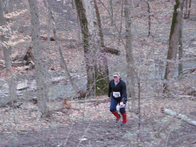
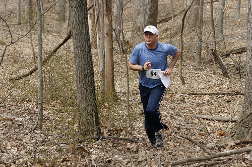
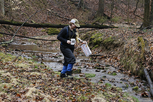
Flying Pig ’09 Orienteering

Our third consecutive year at the Flying Pig – we skipped the sprints this year and participated in the middle and long courses which were both held in Mt. Airy Forest in Cincinnati.   

Melanie at the Flying Pig

We do have to mention a couple of restaurants on the west side of Cincinnati that we happened across during this year’s event.   First – just on the edge of Mt. Airy Forest is the best-named ice cream stand in America (that we currently know of) – Putz’s Dairy Whip.    It’s been there 70-some years and it’s a fine place to stop after a few hours of running about in the woods.

Secondly – our annual Cincinnati Chili fix.   Not that there’s anything at all wrong with Skyline or Gold Star but we’ve been trying to experience the full range of Cincinnati chili parlors.  This year we tried Price Hill Chili which is more of a full service restaurant than Skyline and Gold Star.   The exciting menu item here is the chili omelet.   Probably not the healthiest breakfast in Ohio but you can always afford a few extra calories after an orienteering course.

David at the Flying Pig

Washington Cherry Festival

Since we were in the neighborhood anyway, we dropped by Washington during the week-long Cherry Festival.   There’s not really much of a specific festival per se, more a series of unassociated events with the name “Cherry Festival” attached – as in the Cherry Festival Croquet Tournament.


Cherry trees along the Potomac

The trees are thickest in the lagoon area between the Jefferson and Lincoln monuments.   We intended to visit at least one Smithsonian as well (American Indian) which required circling the National Mall about 5 times until a parking space opened up.    


Washington Monument
Washington Monument

Ran-It Granite

Ran-It Granite is a 3-day orienteering A-meet held a bit west of Baltimore. We stayed in nearby Ellicott City which is a scenic well-preserved town at the bottom of a river gorge – if you can find it amidst all the expressways.

Photo taken by John Landers of QOC
David at Patapsco SP

The terrain at Patapsco has an apparently infinite number of small pits, depressions and other holes that can fill with water during heavy rain and then have a flag placed in them for an orienteering course.

Photo taken by Jan & Dass Merka, QOC
Melanie at Patapsco SP

Big East Fork Trail

This wasn’t our first hike of the year, but it was our first interesting hike – outside of the Asheville commuter section of the Blue Ridge Parkway. The Big East Fork trailhead is on 276 just north of the parkway.

East Fork Pigeon River

There are a couple trails that leave from the area but we followed the Big East Fork trail which follows the Pigeon River all the way up to the headwaters of one particular branch. Just above that the trail meets the Mountains-to-Sea trail near the parkway.

Trout in a creek
Trout in a creek

Along the way are some great swimming holes. Since there was still snow in shaded valleys, we didn’t actually test this. Trout did though and he seemed to like it.

Snowshoe, West Virginia

Normally we don’t take the camera with us for day trips to nearby NC ski areas like Cataloochee and Sugar. We probably should. We did take it to Snowshoe though so we have pictures to post.

snowshoe village
snowshoe village

When we arrived at Snowshoe on Tuesday night it was -7 on top the mountain with an insanely cold wind. By the time we left Thursday afternoon it looked like this in the village square.

East side of Snowshoe

The skiing was fantastic on Wednesday. Uncrowded, good snow and everything was covered. The next day it warmed up to 50 and things got a bit slushy but in general we can’t complain about the skiing at all. We will complain a bit about Snowshoe’s management of the village though. When you check in, they give you a printout of all the stores, restaurants and bars in the village with opening / closing hours for that week. This printout is completely and utterly useless. We didn’t realize it the first night but since things were slow most places just closed when they felt like it. Furthermore, half the places on the list have hours like “open til close”. Very useful. The second night there were actually groups of people roving about on the shuttles trying to find open establishments. Information is generally hard to find at Snowshoe so it’s disappointing that the one thing they do give you is wrong.

Skiing Stillife

You know you’re in West Virginia when the beer comes in mason jars. Actually, Melanie spent at least 45 seconds creating this still life so it had to be included on the blog. The local West Virginia beers are worth seeking out. In general, most places that advertise a wide selection of beer actually carry every brand that can be followed by the word “light”.

Western Territory at Snowshoe

The Western Territory at Snowshoe is really two 1 1/2 mile runs. These are by far the longest runs at Snowshoe and they remain relatively uncrowded because only advanced skiers venture over here.

WNC Nature Center

We actually go to the WNC Nature Center fairly often since it’s located right here in Asheville, but we never post pictures from it, so here are a couple.

jumping wolf

In late afternoon before the nature center closes everything tends to be particularly active (it’s feeding time!). This wolf was doing laps, apparently to build up his appetite.

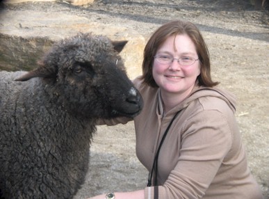
melanie_sheep

We also tend to skip the petting zoo portion but since we were with our 3 year old niece we stopped by. Now, Melanie has a new friend.

Max Patch

Ok, so we were just at Max Patch a few months ago.   However, since we were unable to get up the road to Snowbird Mountain, which was our intended hike, we came back to Max Patch.  

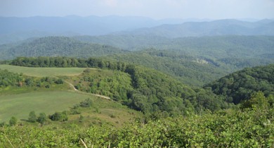
Max Patch View

As always, the views are superb.   The meadows had recently been mown so there was more picnicking and camping than usual on the summit.   We hiked up to Max Patch along the Appalachian Trail from where it crosses the forest road.  After summitting, we followed the trail back down through a patch of forest.  Ultimately it follows a series of meadows that make up an equestrian trail on a parallel ridge. 

Roaring Fork Shelter is only a couple miles north of Max Patch Road.  It doesn’t have direct access to the Roaring Fork river but you’ll have crossed the stream a couple times getting there and its a good place to stop for a snack.

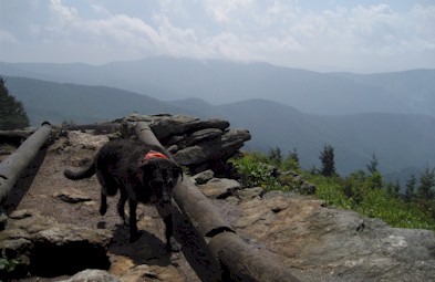
Trout and Mountains

On the hike back, we followed a combination of the equestrian trail and the Max Patch loop trail which stays below the summit but still crosses some big meadows and has excellent views into North Carolina.  Trout found meadow hiking to be altogether confusing as it’s difficult to determine where the trail is.

Southern Brewers Festival

Beer festival season peaks in the southeast in September and October but there’s a few outliers.   Chattanooga’s Southern Brewers Festival is one of those.  It’s held in August when it is roughly 150 degrees in Chattanooga.

Melanie, a beer and the Tennessee River

It’s a token-based beer festival, which means you have to buy a token for each beer.  A token costs $3 so a beer isn’t really a trial size which discourages too much experimentation (only one of our beers ended up in the Tennessee River).  Most of the festival is up along the edge of the city, but the river is more scenic so that’s what we have in the picture.  A nice thing about this festival is that it runs for 11 hours!  So, we arrived in Chattanooga, checked into a downtown hotel and came to the festival for several hours.  In the afternoon we went back and took a nap and then came back for another round.

Krystals

As beer festivals go, the entertainment was pretty good.  In the afternoon things were pretty laid back.  There was a qualifying round for the Krystals World hamburger eating championships.  If you’ve ever seen any competitive eating on TV with that annoying announcer in the carnie hat, let me just say he’s 10 times more annoying in person.   Incidentally, one has to eat 51 Krystals in 10 minutes in order to win a giant trophy.   On the plus side, they handed out the uneaten Krystals afterwards and we can report that after several beers, Krystals actually taste pretty darn good.  

N. Mills River Trail

This hike started and ended at the Hendersonville Resevoir parking area. If you head south from the trailhead, the Trace Ridge trail leads down to the N. Mills River. The last tenth of a mile or so of this trail is extremely steep. It meets the river trail near the confluence of Wash Creek at a very pretty spot.

Wash Creek

The Nat’l Geographic Pisgah map shows the N. Mills trail ending here but it actually extends to the east as far as Yellow Gap Road. To the north and west, the trail runs for about 2 miles to meet a forest service road which connects back up to the trailhead. We did this hike during the drought (yet another drought) due to the high number of river crossings it entails. In fact, we counted 10 river crossings (11 if you start at Yellow Gap Road). One of these has a suspension bridge option, but the rest involving wading. A couple of the crossings were knee deep, even at very low water levels. There are quite a lot of good swimming holes along this trail and it’s a rather popular fishing spot as well.

Mills Crossing

Mt. Craig

We’ve been lax about posting our hikes here lately, so even though this is a short one we’ll include it so we don’t appear to be dead or abducted by aliens.
The Black Mountain Crest trail is notoriously difficult. While we’ve hiked south from Mt. Mitchell back as far as the Blue Ridge Parkway, we hadn’t gone north on the BMCT yet. Our original intent was to travel several miles out. Upon leaving Mt. Mitchell the trail immediately drops several hundred feet. It then runs along a ridge before ascending up to Mt. Craig – the second highest peak in the Eastern US. This is where a rather sudden thunderstorm caught us. This picture is of the trail itself. Not a creek bed.

black mountain crest trail

 A 6000 foot ridge with sheer cliffs on either side is no place to be in a thunderstorm.   With no better option we spent half an hour or more crouched in a grove of spruce trees.   When the storm passed we were drenched.  Worse than that, the already difficult trail was now slickrock with water streaming down it.  We decided we should at least finish summiting Mt. Craig.     It turns out that just 100 feet up the trail or so was a huge rock overhand that would be useful in future pop-up storms.

BMCT

The view from Mt. Craig is worth the difficult, if short (1 mile each way) hike.  From the top you can see… well, we could see cloud.   Eventually the clouds cleared long enough for us to snap a few pictures and see the daunting line of thunderstorms across the western horizon making their way towards us.   Reluctantly we decided that it just wasn’t a good day to be hiking on the highest ridge around and we headed back to Mt. Mitchell.   We actually reached the car just seconds before driving rain started again, followed shortly by hail so perhaps that was a good decision.

Mt. Craig

TurkeyPen

The TurkeyPen trailhead is in the southeastern corner of the Pisgah Ranger District.  It’s got a couple advantages – first there’s a ton of interconnecting trails here so it’s pretty easy to customize a loop of the size you want.   That’s actually a rarity in western NC.     Secondly, many of the trails run along rivers and creeks so it’s a good area when it’s hot out, or when your dog wants to spend all day lying in rivers and creeks.

Mills Crossing

Our dog wanted to spend all day lying about in creeks.   This is the Mills River.  It’s an important feature of the Turkeypen area because several trails cross it.   Most of them literally just run into the river and continue out the other side (see it over there?).   If there’s been a lot of rain recently this can be a very wet proposition.

Bridge

There is one suspension bridge over the river.   Dogs apparently are not fond of swinging bridges.    There were quite a lot of people in the area during our hike.   Probably more than half of them were fishing along the Mills so we only saw a handful of other people along the trails.

snake

We did come across this snake though.   It’s impossible to tell from this picture but this was actually about a 4 foot long snake.  We think it was a racer and it was probably either pregnant or it had just eaten one of those annoying yap dogs we’d passed earlier.   Kudos to the snake either way.

Big Ridge / SlickRock Trail

This was actually sort of a composite day in the Pisgah Ranger District.   We started out hiking along the MST from Big Ridge Overlook.   It looks pretty impressive and much like most of the overlooks around here.

Big Ridge

After this hike we went down to Slick Rock Falls which is an easily accessible waterfall.  It’s visible from a dirt road in the Looking Glass area.  In fact the trail (which we also hiked) goes up to several of the rock climbing routes on the west side of Looking Glass rock.  

Slick Rock Falls

Brown Gap to Max Patch

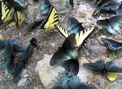
butterflies

Before our hike we spent a little time along Cold Creek in the Harmon Den area. There were hundreds of butterflies drawn to the salt deposits along the road so we have a few dozen pictures that look like this.
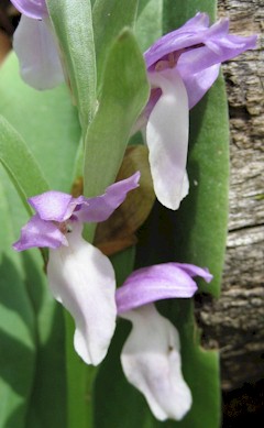
Orchid

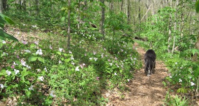
Mid-May is a great time to hike in the area because of the wildflowers. We headed north bound on the A.T. from Brown Gap, which starts with a decent climb but is relatively gentle and rolling after that.
Trilliums

The trilliums were particularly abundant.   They’re a bit hard to see in this picture but all those specks of white and pink are trillium.   It was pretty much deserted on this part of the mountain until we reached Max Patch.  We decided not to climb to the top on this particular day.   Instead we let Trout lie in a stream and cool off while we studied the map.  

We decided we could take an alternate route back to Brown Gap.   This started by taking the A.T. southbound for a quarter mile or so to the junction with the Cherry Creek Trail.   We then took the Cherry Creek trail for maybe a half mile or so until it intersected an old forest service road (named 3533 on some maps).  We left Cherry Creek Trail and followed the road along the ridge.  This worked out great for a while at least.  The road was broad and easy to follow and it was paralleling the A.T. about 200 ft below it.  This is how it looked with a dog in the middle:

Forest Road

About halfway back to Brown Gap the road ends. This was not entirely unexpected as our A.T. map also showed the road ending. Our plan was to orienteer from here by following the 4000 ft. contour line around the ridge until it intersected the A.T. which would be descending towards Brown Gap at that point. Even in May the forest was pretty thick and there was a lot of sharp foliage (blackberries in particular). So when we encountered a really old road bed we decided to follow that instead. This road bed was long unusued and had substantial trees growing in it as well as fallen across it. It was quite clear that bears and deer used it though. Melanie’s theory was that it would connect directly into Brown Gap as we had noticed an old road leaving from a campsite there on our way out. In the end, she was right although it’s a bit of a circuitous route it takes to get there. We did it all with the A.T. map, a compass and an altimeter but I think if we did it again, a better topo map might help.   On the other hand, it would be hard to get seriously lost in this area since everything on this side of the Appalachian Trail drains down to Harmon Den Road.

Little River Canyon

Little River Falls

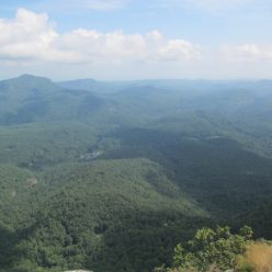
Little River Canyon has two components.  The falls here are sort of in the middle.  The northern section has no road access so we didn’t explore it on this trip.   The southern section has a road running along the west side of the canyon.  Also – we don’t have kids, but if we did, I’m pretty sure we wouldn’t let them stand on the edge of these falls – although they’d be allowed to kayak it if they had a good roll 🙂

Grace’s High Falls

Elsewhere in the canyon are numerous cascades and small waterfalls.   Grace’s High Falls (shown here) are the highest in the canyon.  

Little River Canyon

Little River Canyon has only been part of the National Park system for 8 or 9 years.  Signage is not particularly good.  There are a few overlooks along the canyon and some very select spots where hiking trails descend to the canyon floor.   There’s also about two dozen unmarked pull-outs used by kayakers and climbers.    The only place to get an actual map of the park is at the Canyon Mouth Park which is at the south end.   The road up the rim from Canyon Mouth park is covered in warning signs, but other than being steep and full of switchbacks (as you’d expect), it’s not that bad.

Trout in Little River

From the canyon mouth you can hike up the river.  There’s an assortment of good swimming holes and it was pretty crowded on a Sunday.  About a mile or so upstream we stopped passing other people and eventually spent some time in the river.   Trout in particular was happy to get in the water.

Huntsville, Alabama

Huntsville isn’t really a daytrip from Asheville but it’s an easy weekend trip.   Our primary reason for going was the Whistle Stop Barbeque Competition where we happened to be judging the KCBS event.

Huntsville Depot

This picture is the historic Huntsville Depot where the judging was based.  As BBQ festivals go, this one had a very nice atmosphere with a well-attended amateur division and a busy entertainment schedule.

Huntsville

After the BBQ festival we went up to Monte Sano State Park which overlooks Huntsville and has some nice hiking trails.    It’s a semi-urban setting for a state park, but if you’ve just eaten a pound or so of smoked meat it’s a good place to burn some of it off.