Ok, so we were just at Max Patch a few months ago. However, since we were unable to get up the road to Snowbird Mountain, which was our intended hike, we came back to Max Patch.
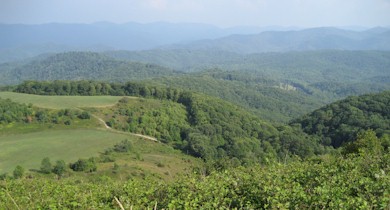
As always, the views are superb. The meadows had recently been mown so there was more picnicking and camping than usual on the summit. We hiked up to Max Patch along the Appalachian Trail from where it crosses the forest road. After summitting, we followed the trail back down through a patch of forest. Ultimately it follows a series of meadows that make up an equestrian trail on a parallel ridge.
Roaring Fork Shelter is only a couple miles north of Max Patch Road. It doesn’t have direct access to the Roaring Fork river but you’ll have crossed the stream a couple times getting there and its a good place to stop for a snack.
On the hike back, we followed a combination of the equestrian trail and the Max Patch loop trail which stays below the summit but still crosses some big meadows and has excellent views into North Carolina. Trout found meadow hiking to be altogether confusing as it’s difficult to determine where the trail is.


