Skinny Dip Falls

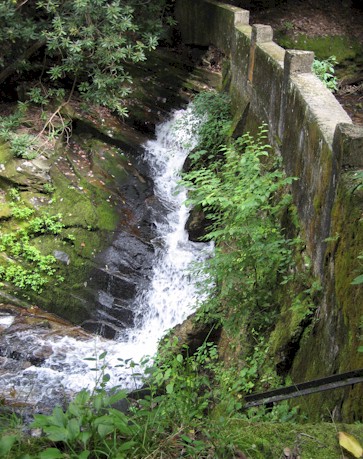
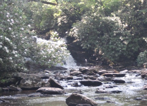
Once upon a time Skinny Dip falls was a secret of sorts. It was a popular swimming hole among those who knew its location. Now it’s a popular swimming hole for everyone passing by on the Blue Ridge Parkway because there are a hundred web sites that mention it, many of them referring to it as a local secret. It’s not.

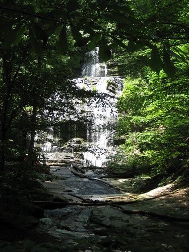
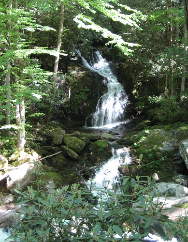
Skinny Dip Falls
Skinny Dip Falls

We actually don’t go here anymore simply because there is rarely parking at the BRP pullout closest to it and it is generally crowded. There are dozens of other perfectly good swimming holes that aren’t. Having said that it’s still a very nice waterfall, a very scenic bit of river and it does lie directly on the MST just below Graveyard Fields.

Skinny Dip Falls
Skinny Dip Falls

As you can see from these pictures, it really does have nice swimming holes. It’s about a half mile hike from the parkway with a relatively small altitude drop so it’s an easy place to get to and not a particularly dangerous place for kids. The three drops that make up the falls are all relatively small.

MST at Skinny Dip Falls

Anyway, we have checked it out once again. It’s still there, albeit now with a lot of nice new wooden boardwalks and benches overlooking the falls. It’s moderately crowded even in March when the water is far too cold to swim in (at least by our standards).
Crabtree Falls

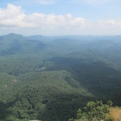
Success at last! (If you’ve been reading the last few entries..) There is an actual waterfall picture with this waterfall.

Crabtree Falls is located on a 2 mile loop accessible from Crabtree Meadows on the Blue Ridge Parkway (near Spruce Pine). There was once a campground here but it has mysteriously disappeared from all Parkway literature and in fact you’ll cross through the overgrown remains of it (ghost campground!) on the hike.
First though, there’s an awesome bit of open pasture between the parking area and the campground which is full of milkweed (and thus butterflies) in midsummer.

Milkweed with butterflies

After that you have several choices. The trail makes a loop with a couple access points to the campground loops. Going counter-clockwise to the falls is steep and rocky with a lot of steps and switchbacks, however, it’s also shorter. The clockwise route is more gentle and more scenic following several tributaries and then Crabtree Creek down to the falls.

Crabtree Falls
Crabtree Falls

These falls are easily visible from a bridge as well as access trails on both sides.

Flat Creek Falls?

Welcome to our second consecutive waterfall fail (sort of). We were on our way from Maggie to Cherokee so we thought we’d get in a small hike somewhere new. We tried Balsam Mountain / Heintooga Ridge Rd off of the Blue Ridge Parkway. This is a less used access point to the Smoky Mountains. In particular, we were headed down the Flat Creek Trail which makes a loop (IF you count the road as part of the loop) from the Balsam Campground area.

Garter Snake
Garter Snake

Notice we are leading with a picture of a garter snake rather than the waterfall. This is a clue that there will be no waterfall picture. Here are the details if you’re on your way to Flat Creek Falls:
First, don’t bother in the summer. There is so much foliage you have no chance of a clear view of the falls. If you insist on trying to find the falls, follow the Flat Creek trail from the parking area along the road. This is actually a lovely trail and crosses a small creek on a log bridge before arriving at a wet crossing (rock-hop) of Bunches Creek. After this you’ll ascend the shoulder of a hill and then descend on the other side. 0.7 miles into the hike you’ll find a sign telling you that you’re 0.7 miles into this hike. This is actually a sign that you should turn towards the river (off trail) and head for the falls. You should be able to hear it from here and there is a faint overgrown trail with all sorts of logs across it. This will reach the river and then run along it to the top of the falls. Usual disclaimers apply, this leads to wet slippery rocks at the top of a large waterfall. The top of the waterfall is (as usual) dangerous and not all that scenic. You can go down a VERY steep trail along the waterfall to the bottom (actually sort of the middle). This trail is little more than an otter slide really and you still won’t have a great view. If you are serious about reaching the bottom of these falls, I’d consider bringing ropes.

Wildflowers
Wildflowers

Having said all that, Flat Creek Trail is a very nice trail, lots of wildflowers in July. Animal tracks everywhere (we only saw snakes) and a creek to keep you company.

Laughing Falls

Laughing Falls.  Perhaps you’ve heard of it?  We hadn’t really and as you may know from scrolling through this blog, we’ve been to a lot of waterfalls in Pisgah.   We were camping at Davidson River and I noticed it on the topo maps.  Close by as the crow flies but not accessible by trail.    Then, Melanie saw a sign at the campground, “Easy to Find Waterfalls” it promised.   They were the usual lot we’d expect – Looking Glass, Slick Rock, Triple, Toxaway.   There on the list was Laughing Falls.   Well, that sealed it, we had to go check this one out.

Just in case you aren’t planning to read any further … don’t go check this one out. It is for the experienced bushwhacker only. It is not an easy hike and on top of that, there’s very little to actually see once you get there.

Laughing Creek
Laughing Creek

This is not it. We don’t have a picture that does it justice because there is no clear view of the falls. If you really must go, take Old 280 just a little east of the Pisgah Forest entrance near Davidson River. Turn left on FR 1360 and follow that uphill until it ends at twin gates. You want the lower (right) road which immediately crosses Laughing Creek at the pleasant little confluence shown in this picture. This is the absolute highlight of this hike. If you choose to go on, after this wet crossing turn left IMMEDIATELY. You’ll probably have second thoughts at this point because there really is not much of a left turn to consider taking. There is a second gate in the woods here indicating what must be one of the least used forest roads in Pisgah. This is little more than a wildlife track at this point. Sections are collapsed or completely buried in rhododendron and mountain laurel. A half mile or so of pushing through this will bring you to the falls. There clearly is an impressive waterfall in here and you’ll get glimpses of it but we were unable to find a reasonable place to get a view of it. Perhaps in winter it’s possible.

Harpers Ferry

So Harpers Ferry isn’t really a day trip from Asheville but we were on our way back and it was a short detour off of I-81. We’ve been associated with the Appalachian Trail and the ATC for years but we’ve never visited Harpers Ferry (home of the ATC) until now. It’s a pretty impressive setting at the confluence of the Potomac and the Shenandoah rivers. The population is under 300 and most of the town is part of the National Historic Site.

Harpers Ferry, WV
Harpers Ferry, WV

Assuming you can park (the train station is the only real parking in town) it’s an easy walk through town to the AT bridge over the Potomac. Once across the trail merges with the 120-mile long C&O Towpath trail which is a nice flat bikeable route from DC to Cumberland, Maryland. The AT runs north bound along the river for a couple miles before it climbs to Weverton Cliffs. There are dozens of other trails out of Harpers Ferry, most of them involve a bit of a climb since it’s up in all directions.

Carl Sandburg Home NHS

The Sandburg Home is a National Historic Site, not necessarily where one would normally think to go hiking but now that we have a two year old along, we’re looking for shorter scenic hikes that involve farm animals. Well, not necessarily but it’s a nice bonus.

goat herd
goat herd

Mrs. Sandburg kept a prize-winning herd of dairy goats and their descendants still live at the home in Flat Rock, NC. Most of this site is free by the way. The goat barn and pens as well as several miles of trail that loop around the property or go up to the top of a nearby hill. The only cost is for touring the home itself.

Carl Sandburg Home
Carl Sandburg Home

We did not tour the home as it did not have nearly as much intrinsic attraction value as say, a goat. At least for a two year old. We did take several trails around the property though and overall it’s a pretty nice location for a short hike. It is particularly popular with dog walkers.

Douglas Falls

Douglas Falls is located in a rarely visited portion of Pisgah National Forest known as the Coleman Boundary. It lies directly below the Craggy Gardens area but is difficult to get to. One way involves hiking down from the MST near Craggy which is an elevation drop of over 2000 ft. The other approach is FS 74 from the vicinity of Barnardsville. This is a very long forest road that passes several other falls visible from the road. Eventually the road ends in a parking lot.

Douglas Falls
Douglas Falls

It’s only a little more than a half mile to the falls which is a 70 ft drop. It’s relatively easy to walk around behind the falls from where this picture was taken.

Eastatoe / Dill Falls

This is a little confusing since the last post involved a South Carolina waterfall called Eastatoe Falls (among other things) and now this one contains a North Carolina waterfall about 10 miles up the road with the same name.
This Eastatoe Falls is located on private property just off Highway 178. The landowners have graciously allowed people to park in their yard (follow signs) and visit the falls.

eastatoe_falls

Dill Falls is located up NC 215 from Rosman almost all the way to the Blue Ridge Parkway. It’s a bit confusing but basically follow Forest Road 4663 to 4663B and follow that one until it ends, park there and hike down the continuation of the road to the river. Incidentally if you’re considering exploring the rest of the 4663 forest road complex, we can tell you that as of late 2013 there are miles and miles of this road with no connection to anything else.

dill_falls

Our old map shows those roads connecting to the Balsam Lake area. They probably still do but it cannot be traversed with a car (4wd or otherwise). Balsam Lake is a nice little lake on the eastern edge of Nantahala National Forest. The building visible here is the Balsam Lake Lodge which can be rented. There are a couple easy short trails along the edge of the lake.

balsam_lake

Station Cove / Eastatoe

Oconee Station is a state historic site in northwest South Carolina. There’s an old outpost there and not really a whole lot else. The Palmetto Trail Connector comes through the park and about a mile north is a branch trail to Station Cove Falls.

Station Cove Falls
Station Cove Falls

There are some good rocks for picnicking here and a couple good spots to play around in the water. We came across this salamander there as well.

Salamander
Salamander

Eastatoe Falls isn’t really related, it’s about 15 miles east on the Foothills Parkway but we visited them on the same day. This waterfall has a bunch of names, Twin Falls on some maps, Shady Cove Falls on others. It’s not even clear to us who owns this land and maintains the trail there. Either way it’s a short walk from the parking area off of water falls road in Eastatoe Community. At the end is a viewing platform and a pretty spectacular vista.

Eastatoe Falls
Eastatoe Falls

There’s a straight drop on the left and a series of cascades on the right. There are many warnings about the dangerous rocks here but the river a bit downstream of the falls looked to have some nice swimming holes accessible from the trail.

South Carolina 107

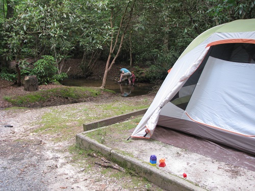
Yes, OK this is a weird title for a post. SC 107 is a relatively short stretch of north-south road in the extreme northwest part of the state. It provides access to Ellicott Rock Wilderness Area, White Rock Scenic Area and several Chattooga River access points. We spent the weekend camping at Cherry Hill which is directly off of 107. It’s a small (20-some sites), quiet, relatively unused campground with hot showers and several creekside sites.

Cherry Hill Campground

Just north of Cherry Hill is Burrell’s Ford Road which runs down to the Chattooga River. North of this is Ellicott Rock Wilderness, south is the walk in sites of Burrell’s Ford campground and a bit in from the Chattooga is King’s Creek Falls.

King's Creek Falls
King’s Creek Falls

To the south from Cherry Hill is Oconee State Park and the Yellow Branch picnic area. This is Yellow Branch Falls which is about a 2 mile hike from the picnic area. There’s a small loop trail through Yellow Branch and the falls trail branches south off of it. There are several wet crossings on the loop trail.

Yellow Branch Falls
Yellow Branch Falls

Yellow Branch Falls has a nice sandy beach area on the far side from the trail and a couple nice pools.

Midnight Hole / Mouse Creek Falls

Both of these locations are on the Big Creek Trail in the Great Smoky Mountains NP. Big Creek is located on the eastern edge of the park on the North Carolina side, near I-40. There’s a ranger station, a horse camp, a group camp and some walk-in tent sites located at Big Creek. Big Creek Trail is one of several that lead out of here and as a horse accessible trail it’s relatively wide and an easy grade.

Midnight Hole
Midnight Hole

Midnight Hole is a fantastic swimming spot about 1.5 miles (2.5 km) up the trail. This a deep clear pool, good rocks for sunning and jumping off of (at your own risk of course) and a spectacular setting in the forest. In late May, this water is also rather on the chilly side.

Mouse Creek Falls
Mouse Creek Falls

Another half mile (0.8 km) up Big Creek Trail is Mouse Creek Falls. You can just barely tell that the noise of Big Creek has gotten slightly louder but there’s a horse hitching rail just before the viewpoint of the falls. Mouse Creek is a tributary that flows in from the south and falls most of the last 100 feet or so into Big Creek. The trail continues from here another three miles to Walnut Bottom Campgrounds and a junction with several other trails, we however did not.

Mount Noble

Mount Noble seems to be a practically unknown hike despite its prime location. It sits just on the southern edge of the Smokies but it is not within the park and no park trails connect to it. The main hiking trail leaves from the very top end of the ‘Unto These Hills’ parking lot in Cherokee. Just keep driving up until you see the private road sign. There’s a red sign pointing towards the trail to Mount Noble.

Turkey Tracks
Turkey Tracks

We saw these turkey tracks in several places near the top of the hike. The lower 80% or so of the hike is an unrelenting climb. Never particularly steep but it also never lets up. It’s a climb of about 1800 feet (550 m) from the parking lot to the summit in just 2.4 miles (3.8 km). There are a couple of nice creek crossings but really no good picnic or stopping spots until you are fairly close to the summit.

Mount Noble Lookout Tower

The namesake lookout tower is at the top. We decided not to climb it since about half the supports were broken or missing and clearly people had been using it as target practice for some time. There are also several large cell towers up here and an assortment of broken glass, barbed wire, mangled fencing and so on. It’s a very nice view of the Smokies, the Nantahala mountains and the Plott Balsams, but the summit itself could use some work. Unfortunately that seems to be true of almost every peak around here that can be accessed by a road / four-wheelers.

Mount Noble View
Mount Noble View

Toms Creek Falls

We’re back! After a lot of bad weather this winter we are finally out hiking again. This is a short hike we did on our way to Charlotte. Tom’s Creek Falls is just off of 221 about five miles north of Marion, North Carolina.

Trail along Tom's Creek
Trail along Tom’s Creek

This is only about a half mile hike along an easy path from the trail head to the falls. There are several nice access points to the creek along the way and a lot of mica scattered all over the place. There is an old mica mine just downstream from the falls (on the opposite of the river from the trail). The falls is quite impressive, especially in March with no foliage.

Tom's Creek Falls
Tom’s Creek Falls

Issaqueena / Spoonauger Falls

Since we were already at Oconee State Park for an orienteering meet, we decided to visit a couple of waterfalls nearby.

Issaqueena barely qualifies as a hike. The top of the falls is practically visible from the parking area. There wasn’t a lot of water flow at this one when we visited but there was some good fall color and you have a view looking out to the south towards the town of Walhalla.

Issaqueena Falls

Spoonauger Falls is located just inside Ellicott Rock Wilderness Area. The hike in is 0.4 miles along the Chattooga River Trail from Burrels Ford Road, then 0.1 miles switchbacking up to the falls. There’s not really a swimming hole at this one but you do have to hike along the Chattooga to get there. We went in November so swimming wasn’t an option. Instead we spent our time there trying to get Alaric to look at the camera for the picture.

Spoonauger Falls

Catawba Falls

Catawba Falls is now a relatively accessible hike. The Foothills Conservancy has put in a nice new trailhead with ample parking and pit restrooms at the end of Catawba Falls Rd. near Old Fort.

Catawba Headwaters

The trail is gentle for most of the hike and follows the Catawba up towards the falls. There is a crossing of the main stream a short distance from the parking area. This can be rock-hopped at normal or low water levels.

Dam near Catawba Falls

There are several falls in this area. Lower Catawba Falls is actually almost impossible to see in the summer due to trees. We don’t have a very good picture of it so here is the river flowing through an old dam instead. There are a couple of old dams along this hike and several ruined power stations and out buildings. This area is a relatively new inclusion to Pisgah National Forest.
The upper falls is not officially accessible on this trail but there is a trail up from the lower falls. I’m told it is dangerous and difficult requiring aid from fixed ropes. Not something we would attempt with the baby carrier.

Luna Moth

From the parking area to the lower falls is about a mile and a quarter. Most of the altitude gain is at the very end, or beyond the very end if you’re continuing to upper falls.

High Falls – South Mills River

High Falls of the South Mills river. It’s a beautiful spot especially with rhododendrons in bloom. There’s quite a lot to say about this one.
First of all, the name is just terrible, this is one of the least ‘high falls’ in Pisgah forest.
It’s also pretty remote. On a hot day when the cars at Looking Glass and Sliding Rock were parked a mile down the road, there was no one at all here. Of course, that may be because there are no marked trails to get here.

High Falls of the South Mills River

The ‘unmaintained’ trails are pretty well marked though and while fairly strenuous hiking, there isn’t much altitude change. The easiest way to get here is to come down the South Mills trail from the Wolf Ford road on the east side of the Pink Beds. At the S. Mills River crossing, follow the unofficial trail up Billy Branch (you can see the confluence from the bridge). Shortly up that trail there is an easy crossing of Billy Branch and the trail returns to the S. Mills. There is also a harder crossing of Billy Branch immediately after leaving S. Mills trail if you’re impatient and like climbing mud banks. This trail crosses one saddle but otherwise stays along the mills eventually crossing it. The crossing is wet and slippery. The falls is not far past that. The river trail does continue to Wolf Ford where it branches with both options rejoining the South Mills trail in different places.

Kelty baby carrier

And now – a complete and utter digression about baby carriers. Those of you who could care less about baby carriers can just quit reading right now.
We normally take Alaric for hikes in an Ergo backpack carrier. It’s comfortable (for me), has a similar feel to a well packed backpack and there’s no real danger to him. On the negative side, he can’t see much beyond my shoulders.
On this hike we tried a Kelty carrier (see picture). It has a crazy high center of balance. Alaric is free to lean over one side and then the other so it’s like 20 pounds of randomly shifting gear. His head is as high as mine so low branches are an issue. All that twisting and crouching gets tiring, but he liked being able to see more. So basically, I’d consider using this carrier again but not on a narrow trail or a hike with any sort of bushwhacking / orienteering and difficult footing. On those I’m sticking with the Ergo.

Burgess Falls State Park

Burgess Falls State Park is just a little south of Cookeville, Tennessee. The park itself is rather small, upon entering it you are almost immediately in the parking lot. There is a playground, picnic area and access to the river above the upper falls which consists of a lot of little uneven ledges and mini-cascades. This is a popular swimming and play area with kids.

Burgess Falls picnic area

A trail leads downstream along one bank of the river. This passes upper falls which is river-wide and then middle falls. The trail is well above the river when it reaches middle falls.

Middle Falls

High Falls at the end of the trail is an impressive sight. High cliff walls on the far side of the river make for a remarkable backdrop. In this picture there are people swimming in several areas at the base of the falls as well as climbing on the lower portions. From the falls viewpoint, a trail descends to the rocks / ‘beach’ at the base.

High Falls

Baskins Creek Falls

The Roaring Fork nature trail is a car trail out of Gatlinburg, Tennessee into the Smokies. There are several major waterfall hikes here of which Baskins Creek seems to be the one that no one takes. Baskins Creek Trail is an L-shaped trail that starts and ends at different locations on the Roaring Fork road. The falls is pretty much right in the middle.

Mountain Laurel

We took the trail from the eastern trailhead simply because it’s a rolling path over several spurs rather than a continuous descent (followed by a continuous ascent on the way back). The first ridge was awash in mountain laurel.

Baskins Creek Falls

The falls is down a steep bit of trail into a quiet cove. There wasn’t much of a swimming hole when we visited but it would be easy enough to stand in the falls.

Salamander

We also saw this salamander at the falls. We’d normally try and ID it but that’s difficult for salamanders so we’ll just leave it at that.

Coontree Mountain

For this hike we parked at the Pisgah Forest stables. We did this apparently because we like to be bothered by horseflies while getting our stuff together. We followed the road to the Bennett Gap trail, followed it north through the junctions with the Coontree loop and continued on to a random highpoint past Coontree Mountain somewhere along Bennett Gap trail. From there we backtracked to Perry Cove and followed that trail back to Avery Creek. The views are probably better in the winter but they aren’t bad. John Rock and Looking Glass Rock are well-situated. This is the view to the northeast towards Clawhammer Mountain.

View from Coontree

This is a good hike to do if you hate your ankles and wish to punish them. Maybe your knees as well. The ascent up Bennett Mountain is actually long but relatively gentle. Once the trail merges with Coontree Loop there are a couple ascents that probably register on the rock climbing difficulty scales. There’s another of those ascents after the saddle that the Perry Cove trail comes out of. North of Perry Cove the trail is along a narrow rocky cliff edge where we stopped to rest and take in the semi-obstructed views.

Bennett Gap Trail

Perry Cove is a wicked descent. We did the hike in this order after looking at it on a topo map. I don’t think I’d really want to climb up Perry Cove. It’s an interesting trail though that covers hardwood cove, some open meadows, several wet stream crossings, old road beds and some great wildflower vales. This is a showy orchus. There is only one plant in this picture so that I don’t have to figure out what the plural of ‘orchus’ is.

Showy Orchus

The loop plus the viewpoint is probably around 4 – 4.5 miles with around 1100 feet of ascent.

Barnett Knob

First a note of warning – this is not a very interesting hike. In fact it’s probably not even worth an entry. Barnett Knob is one of those lookout towers we’ve driven past on the BRP a dozen times and so we finally decided to hike up and check it out.

Barnett Knob

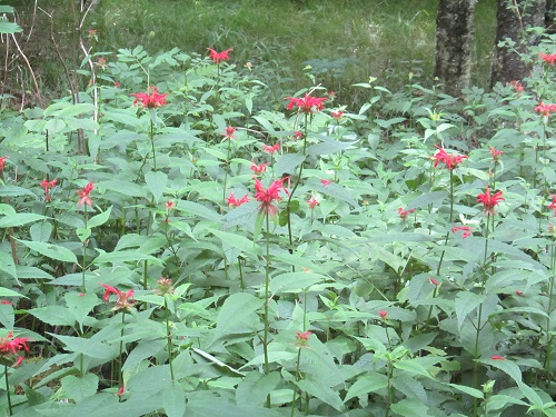
This is just a few miles from the southern terminus at Cherokee/Smoky Mountains NP. There’s a forest road up to the summit but not much of a view once you get there. Some nice wildflowers along the way is about the best we can say for this hike.

Indian Paintbrush