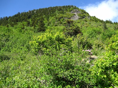
Potato Knob lies at the end of the Black Mountain Range on the border of the Blue Ridge Parkway and Mt Mitchell State Park. It’s the highest point in Buncombe County, although it’s unclear if the summit is in Bumcombe or Yancey. While the summit is just over 6400 ft, Potato Knob is not part of the South Beyond 6000 peaks. We however felt that it need to be climbed anyway. This is a view up at Potato Knob from the Mountains to Sea Trail just south of Mt. Mitchell Rd.
So now lets get all the disclaimers out of the way. This is not a casual peak hike, it requires orienteering which means some skill with a compass and topographic map. There are some seriously large cliffs on all sides of Potato Knob which mandate good route choosing. Also, the south and east side of this mountain are in the restricted Asheville watershed which means that sections of it are completely off-limits (use the MST basically).
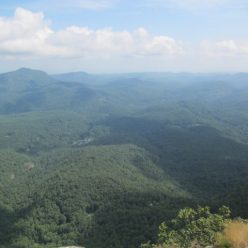
Here is Melanie on the highest rock we could find on the summit of Potato Knob. Note that there isn’t much of a view here in the rhododendron thicket. The actual summit is a survey stake with blue and pink ribbons. The only reason this summit is even slightly accessible is because the county line crosses it, which means there is a old, generally unused survey trail over it. We took the hard way up (a re-entrant off of the MST which required about 700 vertical feet of climbing up rocks and downed trees). The survey trail to the southeast is a bit difficult to follow and skirts some serious drop-offs but it’s much easier than the way we came up. There are also some protruding rocks both near the top and scattered along the way that have spectacular views along the Blue Ridge.


