This hike is just slightly under 8 miles in length. We did it by shuttle with help from the friendly folks at the Hike Inn in Fontana. We parked the car at the Fontana Dam, they shuttled us (and our dog) back around to Yellow Creek Gap and we started from there.
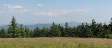
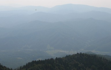
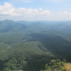
About a mile in is Cable Gap Shelter which is practically right on the trail and has a nice little stream running past it. After Cable Gap there’s a long climb through a series of knolls. Most of this section runs parallel to Fontana Lake and offers nice views. This picture shows a section of the lake and the dam.

Somewhere along here is Walker Gap where the Yellow Creek Mountain trail comes in. This does not appear to be a well marked trail but we’ll save that for some future hike. From Walker Gap to the road at Fontana is an endless series of steep descending switchbacks (unless you happen to be hiking up / south / towards the NOC). There are several nice water sources through here and it ends at the road / marina / shuttle pick up for the Fontana Village (which also has restrooms). From there, the AT continues up and over a knoll along Fontana Lake before descending to the assorted parking areas.
Note that post 9/11 – this section of the trail will be closed during “security threats”. There is an alternate path through Fontana Village and into the Great Smokies downstream of the dam. Just off to the right of this picture is the Fontana AT Shelter which is better known as the Fontana Hilton (because of its relative size for a shelter).

The interior of the dam is now closed to visitors although the overlooks are impressive. On the far side is the boundary of the Great Smoky Mountains National Park where the AT begins a grueling ascent to Clingman’s Dome (30-some miles away by trail). The dam is probably more impressive when the spillways are open into the Little Tennessee River below.